17th to 26th August 2025
The Practical.
The Alta Via 1 is one of several North-to South trekking routes in the Italian Dolomites, the famous region of the Alps characterised by bold, glowing limestone formations. The AV1 is a trek, without via ferrata, from Lago di Braies (Dobbiaco) to La Pissa or La Stanga, with a 40 minute bus ride in to Belluno.
Having really enjoyed it when I did it in 2023, I was keen to do it again. In 2023 we had severe weather as we approached Rifugio Vazzoler and had to change plans. We took a taxi and approached Rifugio Pian de Fontana via the Grasol Valley, instead of the normal route via Rifugio Carestiato and Rifugio Sommariva de Pamperet. The latter route is interesting and very scenic, and goes over Cima de Zita Sud along a narrowish rock ridge involving some scambling. |
Courtesy of Alpine Exploratory
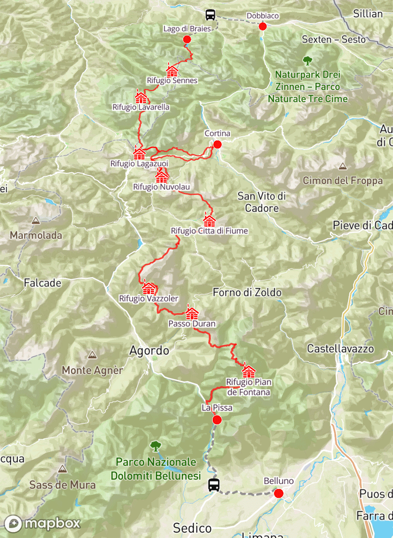
Map Courtesy of Alpine Exploratory
(Note that the "Comfy" and "Guided" itineraries stop at Rufugio Staulanza (Passo Duran), whereas the "Classic"
and "Hutty" itineraries use Citta'di Fiume)
My Garmin GPS Data
(Public transport between Rifugio Lagazuoi and Rifugio Scioatolli due to misty conditions)
| Day |
To |
Distance |
Time |
Elevation in meters |
| |
|
Km |
Elapsed
Hrs-Mins |
Moving
Hrs-Mins |
Gain |
Loss |
Min |
Max |
| 1 |
Lago di Braies to Rifugio Sennes |
11.41 |
6H48 |
4H36 |
1,035 |
391 |
1,498 |
2,398 |
| 2 |
Rifugio Sennes to Rifugio Lavarella |
11.86 |
5H33 |
3H38 |
559 |
653 |
1,549 |
2,140 |
| 3 |
Rifugio Lavarella to Rifugio Lagazuoi |
14.72 |
7H48 |
5H37 |
1,182 |
474 |
2,040 |
2,756 |
| 4a |
Rifugio Lagazuoi To Rifugio Scioatolli (Transport) |
|
|
|
|
|
|
|
| 4b |
Cinque Torri circular |
1.61 |
0H46 |
0H46 |
93 |
93 |
2,198 |
2,261 |
| 4c |
Rifugio Scioatolli to Rifugio Averau |
1.3 |
0H35 |
0H35 |
166 |
0 |
2,254 |
2,421 |
| 5 |
Rifugio Averau to Rifugio Staulanza |
18.12 |
8H22 |
6H09 |
625 |
1,265 |
1,769 |
2,423 |
| 6 |
Rifugio Staulanza to Rifugio Vazzoler |
17.79 |
7H49 |
6H02 |
962 |
1,015 |
1,696 |
2,212 |
| 7 |
Rifugio Vazzoler to Passo Duran |
13.65 |
7H14 |
5H21 |
737 |
858 |
1,409 |
1,944 |
| 8 |
Passo Duran to Rifugio Prampret |
12.2 |
6H07 |
4H08 |
722 |
462 |
1,519 |
1,974 |
| 9a |
Rifugio Prampret to Rifugio Pian de Fontana |
7.26 |
4H20 |
|
563 |
795 |
1,636 |
2,412 |
| 9b |
Pian de Fontana to La Stanga |
14.42 |
5H32 |
|
320 |
1,504 |
444 |
1,751 |
| 9 |
Rifugio Prampret to La Stanga |
21.68 |
9H52 |
7H20 |
883 |
2,299 |
444 |
2,412 |
| |
Total |
124.34 |
|
|
6,964 |
7,510 |
|
|
Note: Garmin data is not consistent between users: your data may be different
Day 9 data shown individually for Rifugio Pamperet to Rifugio Pian de Fontana and from Rifugio Pian de Fontana to La Stanga
Garmin & Outdoor Active Data for Main Group
(Walking conventional route between Rifugio Lagazuoi and Rifugio Averau
including circular of Cinque Torri )
| Day |
To |
Distance |
Time |
Elevation in meters |
| |
|
Km |
Elapsed
Hrs-Mins |
Moving
Hrs-Mins |
Gain |
Loss |
Min |
Max |
| 1 |
Lago di Braies to Rifugio Sennes |
11.41 |
6H48 |
4H36 |
1,035 |
391 |
1,498 |
2,398 |
| 2 |
Rifugio Sennes to Rifugio Lavarella |
11.86 |
5H33 |
3H38 |
559 |
653 |
1,549 |
2,140 |
| 3 |
Rifugio Lavarella to Rifugio Lagazuoi |
14.72 |
7H48 |
5H37 |
1,182 |
474 |
2,040 |
2,756 |
| 4 |
Rifugio Lagazuoi to Rifugio Averau |
20.4 |
8H31 |
6H11 |
769 |
1,155 |
1,972 |
2,800 |
| 5 |
Rifugio Averau to Rifugio Staulanza |
18.12 |
8H22 |
6H09 |
625 |
1,265 |
1,769 |
2,423 |
| 6 |
Rifugio Staulanza to Rifugio Vazzoler |
17.79 |
7H49 |
6H02 |
962 |
1,015 |
1,696 |
2,212 |
| 7 |
Rifugio Vazzoler to Passo Duran |
13.65 |
7H14 |
5H21 |
737 |
858 |
1,409 |
1,944 |
| 8 |
Passo Duran to Rifugio Prampret |
12.2 |
6H07 |
4H08 |
722 |
462 |
1,519 |
1,974 |
| 9 |
Rifugio Prampret to La Stanga |
21.68 |
9H52 |
7H20 |
883 |
2,299 |
444 |
2,412 |
| |
Total |
141.83 |
|
|
7,474 |
8,572 |
|
|
Transport to Cortina d'Ampezzo
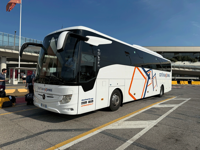
Cortina Express bus from Venice Airport
ETD Venice Airport 17-50 hrs ETA Cortina d'Ampezzo 19-30 hrs
Accommodation
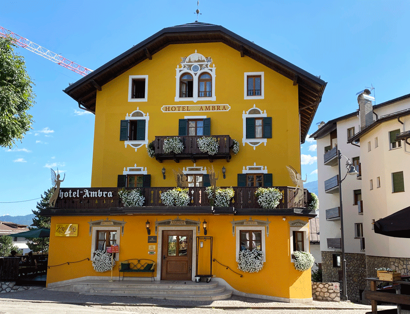
Hotel Ambra

|